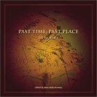
 Past Time, Past Place: GIS for History consists mainly of 11 case studies of geographic information systems being applied to the study of history. It includes a nice sprinkling of full color maps and images and a 20 page glossary of GIS terms. Each case study includes a list of articles and other resources for further reading.
The book begins with an introduction by the editor, Anne Kelly Knowles. This chapter explains the basics of using GIS to study history, as well as giving an overview of how the book is organized.
The meat of the book are the case studies covering the following topics:
- Salem Witch Trials (Benjamin C. Ray)
- Antebellum North and South (Aaron C. Sheehan-Dean)
- Civil War Battlefield Stories (David W. Lowe)
- Immigration, Ethnicity and Race in NYC 1900-2000 (Andrew A. Beveridge)
- Redlining in Philadelphia (Amy Hillier)
- Causes of the Dust Bowl (Geoff Cunfer)
- Agricultural History (Alastair W. Pearson and Peter Collier)
- British Population (Ian N. Gregory and Humphrey R. Southall)
- Archaeology (Trevor M. Harris)
- Mapping the Ancient World (Tom Elliott and Richard Talbert)
- The Electronic Cultural Atlas Initiative and the North American Religion Atlas (Lewis R. Lancaster and David J. Bodenhamer)
I suspect that different audiences will take very different ideas away from this book. I was for looking for information about GIS and historical records (this is another book found during my mad hunt for information on the appraisal and preservation of GIS records) and found a bit of related information to add to my research. I think this book will be of interest to those who fall in any of the following categories:
- Archivists curious about how GIS might enhance access to and understanding of the records under their care
- Historians interested in understanding how GIS can be used to approach historical research in new ways
- History buffs who love reading a good story (complete with pictures)
- Map aficionados curious about new and different kinds of information that can be portrayed with GIS
I especially loved the maps and other images. I am a bit particular when it comes to the quality of graphics – but this book comes through with bright colors and clear images. The unusual square book format (measuring 9″x9″) gave those who arranged the layout lots of room to work – and they took full advantage of the space.
No matter if you plan to read the case studies for the history being brought to life or are looking for “how-tos” as you tackle your own GIS-History project – this book deserves some attention.